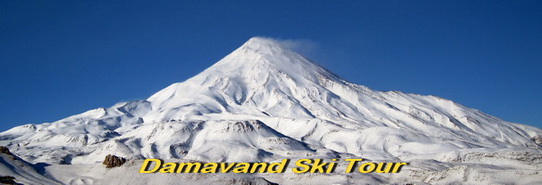
Road and Route Maps Mount Damavand Iran
Essential GPS tracks, road and route maps for Damavand Ski Touring, wild skiing and snowboarding.
The south route has an off-piste mild ski slope suitable for downhill ski descent. These gps tracks help you to find your way in case of bad weather and foggy situation on Damavand Mountain.
Hot to go to Mt Damavand
Tehran> Camp1 Polour> Camp2 Base> Camp3 Bargah > Summit.
IKA Airport to Damawand Camp 1 Polour Resort
GPS Track in GPX format: IKA Airport to Damavand Camp 1 Polour: Download
Full Size Route Map (in jpg format) IKA Airport to Camp1 Polour: Download
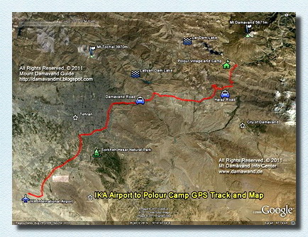
IKA Airport Tehran to Damavand Camp 1 Polour Resort
GPS track and road map
GPS Track Camp 1 Polour to Damavand Camp 2 Base: Download
Full Size Route Map Camp 1 to Camp 2: Download
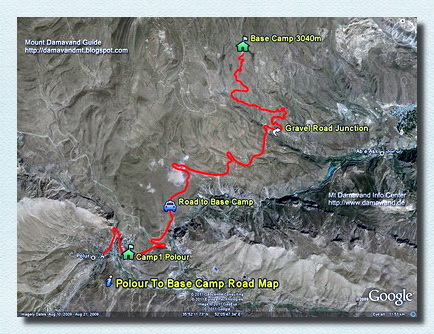
Damawand Camp 1 Polour to Camp 2 Base
GPS track and route map
GPS Track Camp 2 Base to Damavand Camp 3 Bargah Sevom.
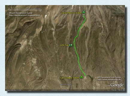
Demavand Camp 2 Base to Camp 3 Bargah Sevom
GPS track and route map
Full Size Route Map Camp3 to Summit: Download
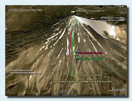
Mt Damavand Camp 3 to Summit
GPS track and route map
Damavand Base Camp
The Damavand Base Camp, also called Goosfand Sara Campsite, is the most convenient and famous base for Mount Damavand treks in Iran. This camp, situated at an altitude of 3,040 meters, features a small refuge, Saheb al Zaman mosque, and a sheepfold. It is the primary starting point for the summer south route, with coordinates of 35.9020° N and 52.1094° E.
Mount Damavand: Ultimate Guide with Facts, Stats, and Insights on Iran’s Highest Peak
Discover everything about Mount Damavand, Iran’s highest peak and a geological marvel in the heart of the Alborz range. With an elevation of 5,671 meters (18,606 feet), this dormant volcano is renowned for its picturesque scenery, unique fumaroles, and historical significance. This ultimate guide delves into the mountain’s volcanic origins, its ranking among the world's tallest volcanoes, and the cultural legends associated with it. Gain insights into the best climbing seasons, available routes, and preparation tips to ensure a safe and enjoyable trek. Whether you are an avid mountaineer or a history enthusiast, Mount Damavand offers something for everyone. Learn about local traditions, nearby attractions, and essential logistics to plan your visit. This guide is your gateway to experiencing the unparalleled beauty and adventure that Mount Damavand offers.
Damavand Route Maps and GPS tracks 24DST1216J
All Rights Reserved. © Damavand Ski Tour
All the material on this website is protected by copyright.